Iran blames Google Earth of spying, plans similar ‘Islamic’ service

The Iranian version of Google Earth will be named 'Basir' and may go live in four months.
The Iranian government has blamed Google Earth of being run by American, British and Israeli intelligence agencies and has revealed that it is working on an ‘Islamic’ version which will also have a global reach. Iran’s minister of telecommunications, Hassan Nami has announced that the Iranian global mapping service, dubbed ‘Basir’ (which means ‘Spectator’ in Farsi) will go live in four months and will include 3D maps.
According to The Guardian, other Iranian officials apart from Nami have also raised concerns about Google Earth being used as a spying tool by Western intelligence agencies. As a result, while most Iranian users can access Google Earth and other Google services, there have been cases where results have been filtered and some sites even blocked by different Iranian ISPs. The Iranian government has blocked around five million websites from being accessed by Iranian Internet users.
While Nami failed to explain what he meant by an ‘Islamic’ mapping service, he did state, “We are developing this service with the Islamic views we have in Iran and we will put a kind of information on our website that would take people of the world towards reality … Our values in Iran are the values of God and this would be the difference between Basir and the Google Earth, which belongs to the ominous triangle of the US, England and the Zionists.”
An IT specialist who has worked in Iran raised doubts about the mapping service while speaking to The Guardian. He said that the mapping service was bound to fail as it was only reliant on government funding, had no business model and would require IT infrastructure that Iran didn’t have.
At the end of the day, the project may be shelved very soon not because of technical difficulties but rather because of political reasons. The current government is scheduled to be dissolved after Iranian President Mahmoud Ahmadinejad steps down in June and fresh elections are held.
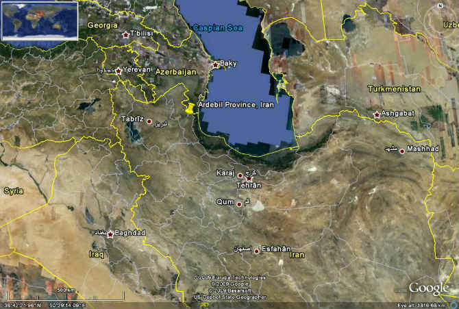
Iran, as seen on Google Earth.
While there is no evidence of Google Earth being used by intelligence agencies, it’s worth pointing out that the service was originally invented by a company called Keyhole that was funded by the C.I.A. Keyhole was acquired by Google in 2004 and at the time of its acquisition, Keyhole was handling contracts for the US Army and the United States Department of Defence.
The company was itself named after the Keyhole reconnaissance satellites used by U.S. intelligence agencies for spying, and, most recently, to identify the compound where Osama Bin Laden was hiding out in Pakistan.
Source: The Guardian

