
HIGHLIGHTS
Explore the planet using Google Earth, which also includes some really cool 3D models of buildings and popular structures
Google Earth is a free software which allows you to explore detailed aerial photos and satellite imagery of planet Earth. Google Earth is easy to use and consists of both professional and community-based contributions. It is undisputedly the best free mapping software available today.
Learn mouse gestures for easy navigation
Google Earth is fairly easy to navigate on a laptop trackpad but using a mouse with a scroll-wheel makes a whole world of difference. Navigating with a scroll-wheel allows for quick and controlled zooming in and zooming out. Also, holding down the scroll-wheel button lets you tilt the world around, and holding down the right-mouse button turns your mouse into a virtual joystick which lets you freely zoom-in and out with ease.
Adjust orientation to due north
If you went overboard with the mouse and now your worlds all messed up and upside-down, simply clicking on the N in navigation controls will set you right. Just pressing the [N] key on the keyboard works just as well.
Go back in time
The Historical Imagery button, i.e. the clock button in the toolbar allows you to turn back time and take a look at what Earth used to look like. This gives you a slider which you can adjust to view images of the Earth dating back to the 1930’s. This is especially handy if you want to compare images of Earth before and after major events occurred in the past.
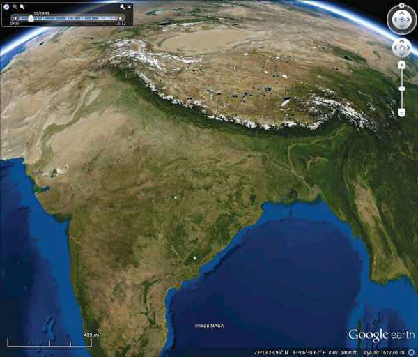
Go back in time with Historical Imagery
Zoom Smoother
Victims of slow internet connections and weak machines will find that quickly zooming-in and out is laggy and the imagery takes forever to process, an issue faced by many. In this case, it might be a good idea to go ahead and increase the cache size of stored images. At the cost of using more of your memory/hard disk space, zooming is considerably faster and smoother. This also improves the speed at which layers load, including 3D models. The cache size can be increased by accessing the Tools menu and then selecting Options… and selecting the Cache tab.
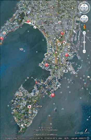
Hundreds of layer options
Set a starting location
The Earth is pretty big, and it’s easy to get lost exploring it. It happens to the best of us, and nobody blames you. So, if you do find yourself lost with no clue as to where you are, simply double-click on the Primary Database in the layers section. This automatically sets you to 0 N 0 E, which is Google Earth’s default starting location.
Additionally, you can set your own starting location. After setting the view that you want when you open Google Earth, the ‘Make this my start location’ option in the View menu will place a marker called Starting Location which can be found under My Places. Double-clicking this marker will return you to your start location.
Use Google Earth for Research
Google Earth has many layers devoted exclusively to science and information. Additionally, under the More Layers sub-menu, the Wikipedia layer can be turned on at any time. This provides users with a short Wikipedia article related to the specified location. Furthermore, under the Photos Layer sub-menu, 360cities is an interesting layer which takes users into hi-res interact-able photos for close-up views of places.
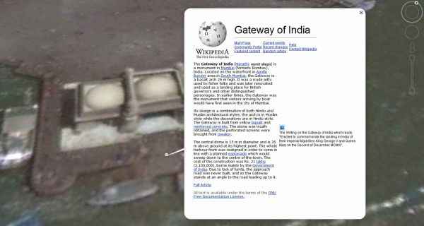
The Wikipedia icon appears as a white box with a black W
The huge amounts of information stored in these layers is quite staggering. The Ocean, Gallery and Global Awareness layers contain all kinds of material relating to general and scientific topics, and current events. From text and images contributed by NASA, to audio and video content from National Geographic and Discovery, it’s very easy to drown in this sea of information. And this is only scratching the surface of the abundance of information that Google Earth readily offers its users.
However, having ALL of those layers on at once is not advisable, especially layers which work in real time, i.e., layers like Weather and Traffic. You will find that Earth will literally slow down. If you do find yourself in a position where you’ve got too many layers active, simply uncheck the Primary Database, take it slow, and proceed to turn only layers you need on. You’ll thank yourself later for doing this.
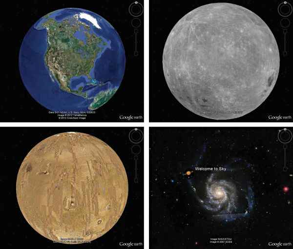
Explore beyond just Earth
Try the flight simulator
Google Earth has its very own flight simulator! This can be accessed through the Enter Flight Simulator option in the Tools menu. At the interface, you choose your aircraft and pick a location to start at, which could be any airport in the world. The controls take a little getting used to, but once you get the hang of it, it’s quite addictive.
Take to the Sky, or the Moon, or do you fancy Mars? If you get bored of looking down at Earth, you can always switch things up and look up to the skies. Google Earth lets you observe celestial objects and constellations, complete with images and videos provided by NASA. It doesn’t end with the Sky though – you could go beyond the skies and go visit Mars, and the Moon, and maybe take a tour or two about the historic Apollo program. Access this feature by clicking on the button with an image of Saturn on it in the toolbar.
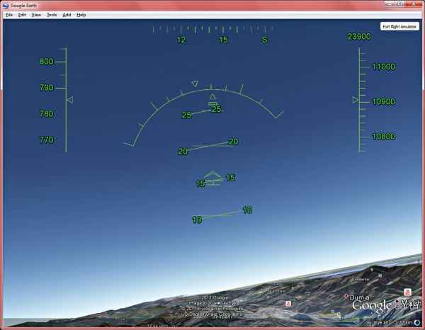
Take in breath-taking views with the flight simulator
Google Earth has no shortage of places to explore and visit. The Layers database and information is constantly being updated and new content is added on a regular basis, so don’t stop exploring and look out for newer features in the future.