Decoded: Key aviation technologies
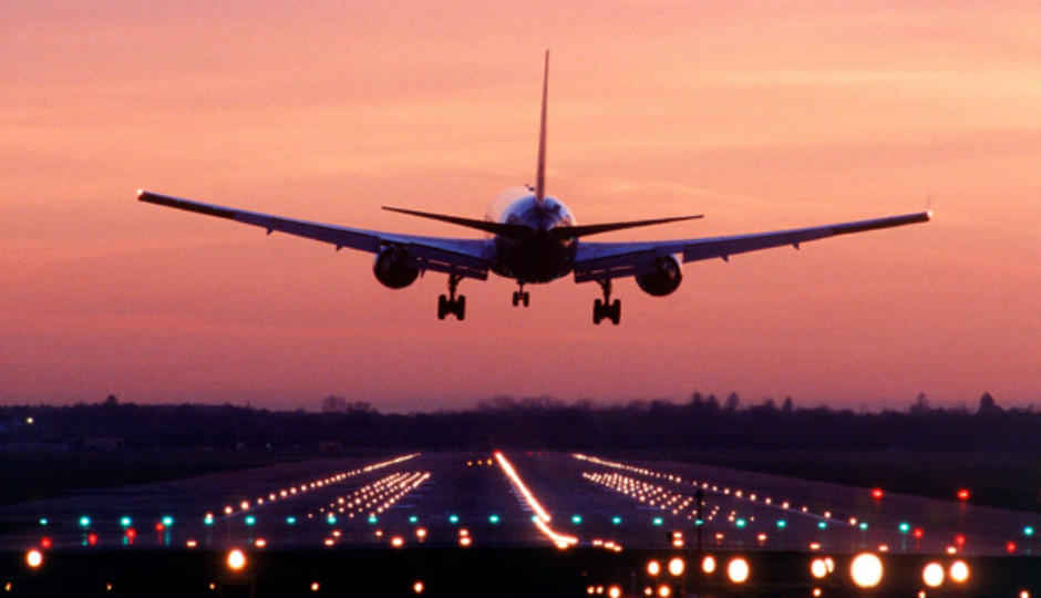
Despite all the risks and hazards, here’s how technology powers aviation to be among the safest ways of commercial travel across the world.
There has always been a lot of myth involved with aviation, and aerospace mobility in general. This particular field of locomotion has always played guest to the latest advanced technologies in both commercial and combat guise – radars, augmented reality displays, you name it. Surprisingly, when you get down to decoding the field of advanced technologies at play in aerospace and aviation, it doesn’t seem too bafflingly complicated. There are clear areas where a select technologies are used, the improvements and changes are released across a long span of time. In a way, all of this works very similar to how on-ground mobility (cars, for a more colloquial term) works.
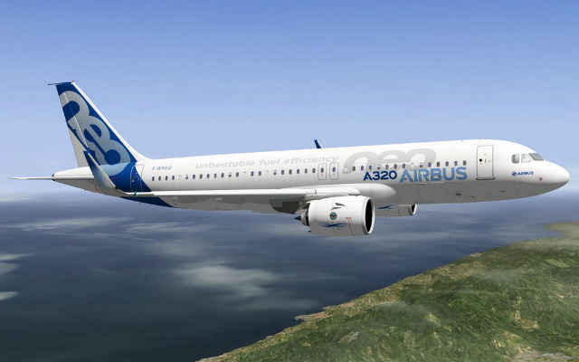
But, there’s a lot more at stake here. For beginners, aviation is a far riskier and significantly more expensive industry than the automobile industry. Take one of the most commonly-used, average passenger aircraft in India today – the Airbus A320. On a standard flying route between Mumbai to Delhi, an Airbus A320 licensed by any of the operating airlines typically flies with over 150 people onboard, covering an aerial distance of 1,150 kilometres in roughly one hour and 45 minutes. It cruises at peak altitude of around 35,000 feet, and assuming all conditions are ideal (no turbulent winds, optimal cruising speed, standard overall weight, etc.), will fly at around 850 kmph (ground speed), and consume around 3,750 litres of Jet A1 fuel for every 1,000 kilometres flown. At this estimate, and at the present rate of jet fuel, the standard flight from Mumbai to Delhi will consume approximately Rs. 2,15,000 worth of just fuel, barring all other ancillary expenses (maintenance, services, licensing, salaries and so on).
The Airbus A320neo – a new breed of ultra high-tech, safe aircrafts
Furthermore, the stakes are significantly higher. Air travel, for obvious reasons, is riskier than road travel. There are multiple factors that need to be kept in check – constant maintenance and upkeep of myriad, complex parts of the aircraft, weather conditions, landing gear and so many other tiny elements. Any instance of breakdown can be fatal, since unlike a car, an aircraft cannot simply slow down and stop by a floating cloud, and simply wait for a mechanic to arrive with a bunch of spanners. How then, has airspace typically always been the safest way of travelling? Year-by-year, in face of significantly rising commuters, air travel produces the least number of deaths and injuries in comparison to road, or even train travel. The answer to all this lies in the core technologies that keep aviation ticking. Neelu Khatri, President of Aerospace at Honeywell India, provides us all the key details.
Tackling flight efficiency
Honeywell Aerospace has been building technologies for the aviation sector for nearly a century now. At Honeywell India, the key focus is on getting the Indian aerospace players onboard to use technologies that it develops for global service providers. Khatri puts this to the context of the Indian aerospace, stating, "If we look at technology that is helping the India market specifically, it’s worth thinking about the impact of rising oil prices, which is putting the Indian low-fare airline market under pressure to offset fuel costs by raising passenger airfares. That’s where Honeywell comes in. We’re helping to ensure airlines like Jet Airways don’t have to raise airfare, by providing a solution focused on driving fuel efficiency. Our GoDirect Flight Efficiency software provides data analysis, reporting and monitoring tools to help conserve fuel, while reducing costs and environmental impact."
Neelu Khatri, President of Aerospace at Honeywell India
The GoDirect flight efficiency software is a suite of algorithms onboard aircrafts and air terminals that help an airline become more efficient. These algorithms are run through simulators to train them on real-life situations, and are steadily improved using machine learning. This, in turn, takes care of two key elements – flight route planning and scheduling of different routes depending on weather, previous flight data and other such factors. The flight efficiency software uses data analytics to give all the information in a terminal to the pilot, using AI algorithms based on previous flight data and present air traffic conditions. Furthermore, the GoDirect algorithms take information from a large database of airports around the world and provide projections of the same to pilots. They can then preview airport patterns and terrain to plot out the best possible path for take-off and landing.
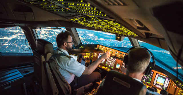
A typical, new-generation aircraft cockpit
This, too, is assisted by GoDirect algorithms as take-off and landing take to most amount of fuel. The algorithms provide real-time route analyses to aircraft cockpits, autonomously suggesting air path shortcuts that pilots can then request air traffic control stations to approve. The airport database also allows pilots to undertake “acceleration altitude reductions” and “continuous descent operations” – two key moves that can help airlines majorly reduce fuel consumption.
Once airborne, the GoDirect suite also provides real-time analysis of weather conditions by using external sensors and direct satellite communication. The vertical optimisation tool onboard the GoDirect suite provides real-time alerts to pilots to adjust flight altitude differently from pre-drawn flight plans in order to avoid turbulence – yet another key factor for increased fuel consumption.
In India, private airspace operator Jet Airways presently equips its aircrafts with the GoDirect Flight Efficiency software among its suite of onboard avionics.
Take-off and landing
The take-off and landing procedures are directly related to maintaining fuel efficiency onboard an aircraft. However, much of this technology is handled by three different suites of equipment – Flight Preview, SmartRunway and SmartLanding. The latter of the two are part of the Enhanced Ground Proximity Warning System, which itself is classified in terms of proficiency into multiple product lines, each of which are built for specific classes of aircrafts.
With GoDirect Flight Preview, Khatri explains, "Pilots can pre-plan their approach before flying into an airport by viewing an exact picture of the runway environment on a tablet. The application shows a traditional chart and gives pilots a 3D view of the approach, increasing situational awareness. Additionally, pilots can use Flight Preview before or during their flight to get a clear picture of conditions they’ll encounter during an approach and landing. There is no need for communication between the ground staff and cabin crew as all the data is pre-loaded on the iPad."
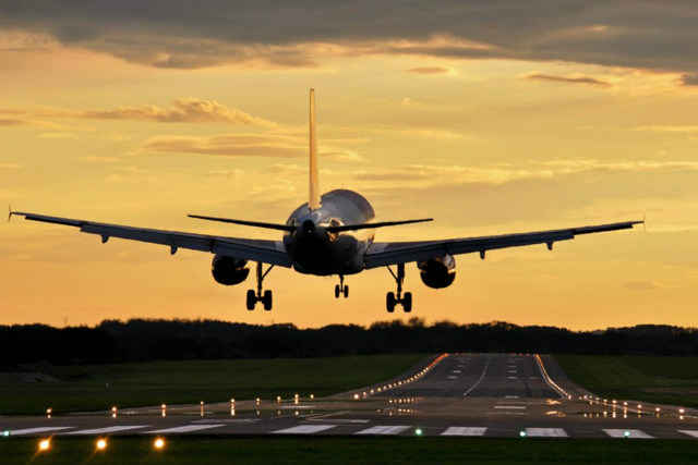
Tools like the EGPWS facilitate landing through any weather and condition, on almost any runway
The Flight Preview system is loaded on an iPad, and has surprisingly lenient system requirements – an iPad 3 running on iOS 8.4 is good enough. It actually uses real-time satellite data to augment it on 3D-modelled surfaces, effectively giving pilots a clear view of the landing trajectory ahead. It is also surprisingly cost-effective, with the Flight Preview including approach plate data that need to be subscribed on a monthly/yearly basis per iPad. These charges vary by region, but are in the region of about $2 every month. This particularly helps getting a better view of approach trajectories, particularly through turbulent weather.
Chipping in here is the SmartPath Ground Based Augmentation System (GBAS). Khatri explains, "The SmartPath Ground Based Augmentation System (GBAS) provides aircraft with augmented and highly accurate satellite navigation data, using GPS signals to provide precise positioning guidance during the final stages of an approach – both horizontal and vertical. Because of this capability, the system allows for a safer, more efficient descent and landing, and is said to be a potential replacement for ILS, building on existing technology capability and safety features that the ILS currently provides."
What this essentially does is use satellite data and radars to draw a "very precise, high integrity digital navigation data", which contributes to the technology available to air traffic control officials back on the ground. While the radar helps scan the skies and put elements on a map based on the onboard transponder, the GBAS helps improve precision and visual imagery of the data, which then allows air traffic control to trace trajectories and precise locations of an aircraft, including altitude data. This helps it control requests from aircrafts for altitude changes, alongside maintaining a very safe distance between two airborne flights.
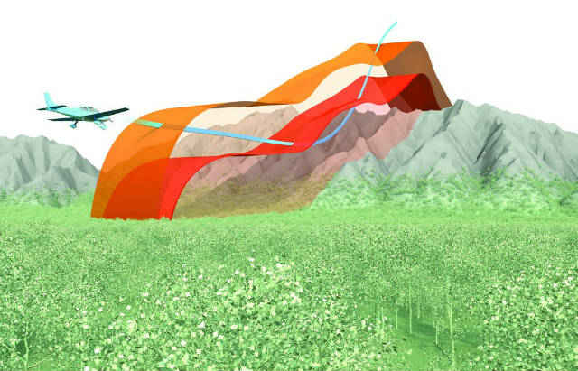
Just like TARS in Interstellar, TAWS has saved countless perilous flight journeys
The key technology here, though, is the Enhanced Ground Proximity Warning System (EGPWS). The EGPWS products are Terrain Awareness and Warning Systems (TAWS), which are each designed for particular classes of aircrafts, and work in tandem with the integrated avionics computers and the respective instrumentation platforms. The EGPWS Mark V and V-A, for instance, include an onboard processor, requisite memory and multiple Ethernet ports to support additional displays for monitoring multiple aspects like obstacles and terrain during the landing approach.
What we focus on here are the SmartRunway and SmartLanding systems – both being crucial elements of the latest Runway Awareness and Advisory Systems (RAAS) onboard aircrafts with digital instrumentation panels. The equipment is certified for flight instrumentation platforms that power both Airbus and Boeing. Before proceeding further, though, here’s what you need to know about a typical aircraft instrumentation platform (the multiple screens, controllers and buttons that you may have glanced at).
Take the Garmin G1000, for example. The typical flight instrumentation and avionics setup of the Garmin G1000 includes:
- Primary flight display (PFD): Showing controls to all flight instruments, airspeed, compass and course deviation indicators, flight plan access, the altimeter, a transponder squawk code initiator, and even a level of redundancy through software that allows it to take over the multifunction display (MFD) in case the second display fails.
- Multifunction display (MFD): Also referred to as the second display, this typically shows all the engine statistics and data, and a moving terrain map. It can also show air traffic report, nearest airport data and updates and flight plan programming – elements that the likes of the Honeywell RAAS system take information from (note: the two are not the same, but separate elements served by two different companies).
The other elements include an audio panel for selecting audio source for each pilot, physical remote controllers for easier access of airplane pathways, the full integrated avionics units (IAU) that include the full communications and navigation radio, satellite-linked GPS transceiver, a host of supporting processors and memory, additional slots for facilitating firmware and database updates, and scope for adding precision approach and landing modules like the Honeywell GoDirect SmartRunway and SmartLanding systems. There is also an engine and airframe unit, a transponder, a magnetometer, an altitude and heading reference system (AHRS) to monitor accidental altitude skids, an air data computer and the data aggregator to wrap it all up. Each and every of these systems also have multiple redundancies to support any technical failures.
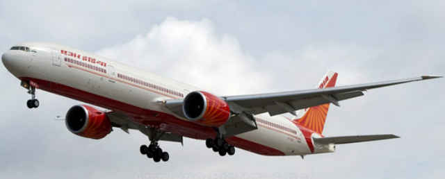
The Air India Boeing 777-300ER is equipped with SmartLanding systems in international routes
Coming to the SmartRunway and SmartLanding systems, these software elements take power from the onboard computers to facilitate active runway assistance for pilots. The systems run on the MFD of an aircraft with digital instrument clusters, i.e. most passenger aircrafts nowadays, and is key to using all the onboard imaging and sensory equipment for preventing an accidents on the runway, during taxi, and while taking-off or landing. Khatri explains, "They benefit from the long legacy of that hardware and utilize the geometric algorithms, radar auto tilt and long list of aircraft parameters built into the system. They are designed to minimise runway incursions and excursions by improving the situational awareness of pilots and crew with a combination of audio alerts and visual messaging during taxi, takeoff, approach and landing. By doing so, pilots benefit from a measured approach, decreasing the risk of long landings, hard landings, tail strikes and runway collisions. Using these systems can improve flight safety by providing timely information and quieting the cockpit."
India’s flag-bearer up in the skies, Air India, is one of the key subscribers to Honeywell’s integrated SmartRunway and SmartLanding services. Khatri states, "Air India is using Honeywell’s SmartRunway/SmartLanding with its international Boeing 777 fleet to make it easier to navigate airports for landing, taxiing and take-off. In addition, it is in use at Chennai Airport to increase airspace capacity and improve air traffic control flexibility."
Predicting and tackling weather
The instrumentation panel onboard an aircraft is supported majorly by databases that fail-safe the procedures of taxiing, take-off and landing, alongside projecting efficient flight paths, by using advanced algorithms and external hardware. Key to all of this, particularly once an aircraft is airborne, is weather prediction and management systems, which are the main suppliers of information to flight efficiency algorithms and takeoff/landing support.
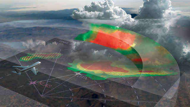
Chasing storms – the IntuVue RDR-4000 3D weather radar system
Weather radars, for this reason, are key to flight safety. Take, for instance, the IntuVue RDR-4000 3D weather radar system, which comes with the added advantage of an easy-to-read interface – a key factor when you are reading emergency weather alerts. The radar provides a three-dimensional weather map of up to 180 degrees around the aircraft, ranging up to 320 nautical miles ahead of the aircraft and spanning all the way from ground to 60,000 feet. This helps pilots predict routes based on storms ahead, and request deviation from planned path well before hitting a storm cloud. It further provides 3D imagery of storm cells, and works in tandem with path-planning algorithms and the EGPWS to help alter routes and particularly help during landings. This is one of the biggest elements that are at play in terms of flight safety, and helps majorly as a number of fatal aircraft accidents have occurred owing to unforeseen storms.
Khatri further adds, "(these) technologies help operators overcome problems caused by adverse weather that impact flight safety. India’s terrain, weather and topographical patterns in particular, differ across regions, which makes it difficult for pilots to consistently navigate routes, fly and land safely and efficiently. Air India is using our IntuVue RDR-4000 3D Weather Radar System to get accurate weather updates that help improve flight safety by enabling pilots to ‘see’ upcoming weather conditions and turbulence via predictive warnings."
Aircraft surveillance systems
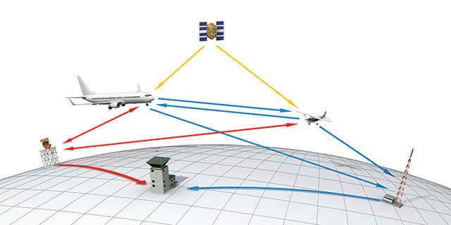
Typically, how air traffic surveillance works is by ground radars sending a ‘ping’, or a request, based on which the transponder onboard an aircraft would ‘reply’ with an encoded signature, thereby relaying its exact location and coordinates to the radar down below. This procedure is known in aviation parlance as a ‘handshake’, and establishes communication between aircraft and civilian radar. The same is also tracked by a military radar, too.
Key improvement to the previously-established primary surveillance radar (PSR) and secondary surveillance radar (SSR) is the new Automatic Dependant Surveillance – Broadcast (ADS-B) radar, which improves surveillance, situational awareness, visibility and redundancy for safety majorly. The Airports Authority of India is in line to upgrade aircrafts in its airspace to the new standards, over due course of time. Khatri explains, "The Automatic Dependent Surveillance-Broadcast (ADS-B) mandate will require aircraft flying in the U.S. and E.U. airspace to be compliant and equipped with ADS-B by the year 2020. The deadline is 1 January for the U.S. and 7 June for Europe. With that mind, ADS-B will likely replace Primary Surveillance Radar (PSR) as the central method used by air traffic control."
The flow of information facilitated by the ADS-B radar
She also adds, "While PSR and SSR have been used for a long time, it’s not as accurate or reliable. ADS-B is essential if pilots want to fly post 2020. The sooner aircraft owners get started with the upgrade process, the more choice and flexibility there will be in the product selection process, pace of installation and path to upgrade."
While all of this is good, this is one field where airlines seem to be lagging behind by a fair margin. The reasons include considerable need for investment, and an overhaul in existing surveillance infrastructure onboard aircrafts. Khatri explains, "In 2017, the FAA estimated there are more than 150,000 aircraft yet to be equipped with ADS-B. With 18 months left until the deadline, time is quickly running out. In the US, currently an average of 75 aircraft are equipped per month and if that continues, there is a possibility that more than 18,000 aircraft will be grounded due to non-compliance come 2020. Honeywell’s SmartTraffic TCAS is used by air traffic control (ATC) to detect ADS-B installed on aircraft, essentially helping to ATC learn which aircraft are compliant with ADS-B. As we get closer to the ADS-B deadline, becoming compliant is coming increasingly important and ATC will have a huge job on their hands come 2020."
Airspace technology, hence, is primarily sensitive and advanced in terms of using augmented reality, large databases, advanced algorithms and a host of redundancies in both hardware and software, which enable aviation to report sky-high figures of safety. Airline operators in India, too, are actively investing in the latest technologies to make flying more efficient, cost-effective, highly automated and even safer. The operators subscribing to these services also include India’s largest volume air operator, IndiGo. Khatri says, "In 2015, local airline IndiGo signed a contract to feature their A320neo fleet with a suite of avionics technologies including safety focused cockpit systems that enable pilots to better monitor the surrounding airspace and provide greater situational awareness. IndiGo is also making use of Honeywell’s flight management systems, which automate flight planning from point A to point B, in addition to use of its products to handle maintenance requirements for the Honeywell 131-9A APU."
In-flight connectivity, and the way forward
Khatri concludes a thorough investigation into the technology behind aviation, giving an insight into a peripheral yet critical-to-lifestyle change that is headed for Indian aviation sector, soon. She also gives a foreword into the space of connected aircrafts, stating:
"While the aviation industry is constantly changing and looking to implement new technologies, each market is developing at a different pace. Recently, the Department of Telecommunications approved in-flight connectivity in India, giving Honeywell the opportunity to play a big role in creating better in-flight experiences by providing access to seamless Wi-Fi in the sky. Currently, only local providers are officially able to offer these services, but in the future, we’d like to be able to offer local customers our JetWave hardware, allowing commercial and military customers to connect to Inmarsat’s Global Xpress constellation.
The Connected Aircraft is driving a revolution within the aviation industry. Specifically, we’re seeing developments in the use of connectivity and data in regards to real-time weather tracking, flight planning and maintenance. More pilots are using real-time data to avoid harmful weather conditions and guarantee a safer journey. Flight-planning applications let pilots preview the flight path for take-off and landing to minimize delays and help passengers reach their destinations on time. Additionally, maintainers are seeing how predictive maintenance identifies mechanical parts that need to be fixed or replaced before an aircraft is grounded, ensuring it’s well maintained and downtime is decreased.
All this is possible through connectivity on and off the aircraft, utilizing data to help flight crews and pilots provide the safest and most efficient flights for passengers, at all times."
The story above talks mainly about the avionics and key software-based technologies contributing to the field of aviation. In future editions of Decoded, we aim to cover further incisive technologies across varied fields. Have a question, or an opinion, or even a suggestion? Please write to us, at editor@digit.in.

